Google Maps is one of the more popular GPS Navigation tools on the market today. You can easily find points of interest, restaurants, and map routes tailored to your needs in just a few clicks. But what if you want to map out a location that isn’t already pinned? You will need to get the GPS coordinates for that location to stay on track.
If you need the exact coordinates of a specific location on a map, Google Maps is the most efficient and accurate way to get them. You can also use Google Maps to find a place based on its GPS coordinates. GPS coordinates will uniquely point to a location on a map, and you can use the coordinates to set up a meeting place or make sure your directions are correct.
In this article, we’ll show you exactly how to get GPS coordinates in Google Maps.
How to Get GPS Coordinates in Google Maps on the iPhone
Most users take advantage of Google Maps while on the go. As users’ phones are often connected to the internet, it’s easy to set up your GPS from your device. To get GPS coordinates for a location on a map, follow these steps:
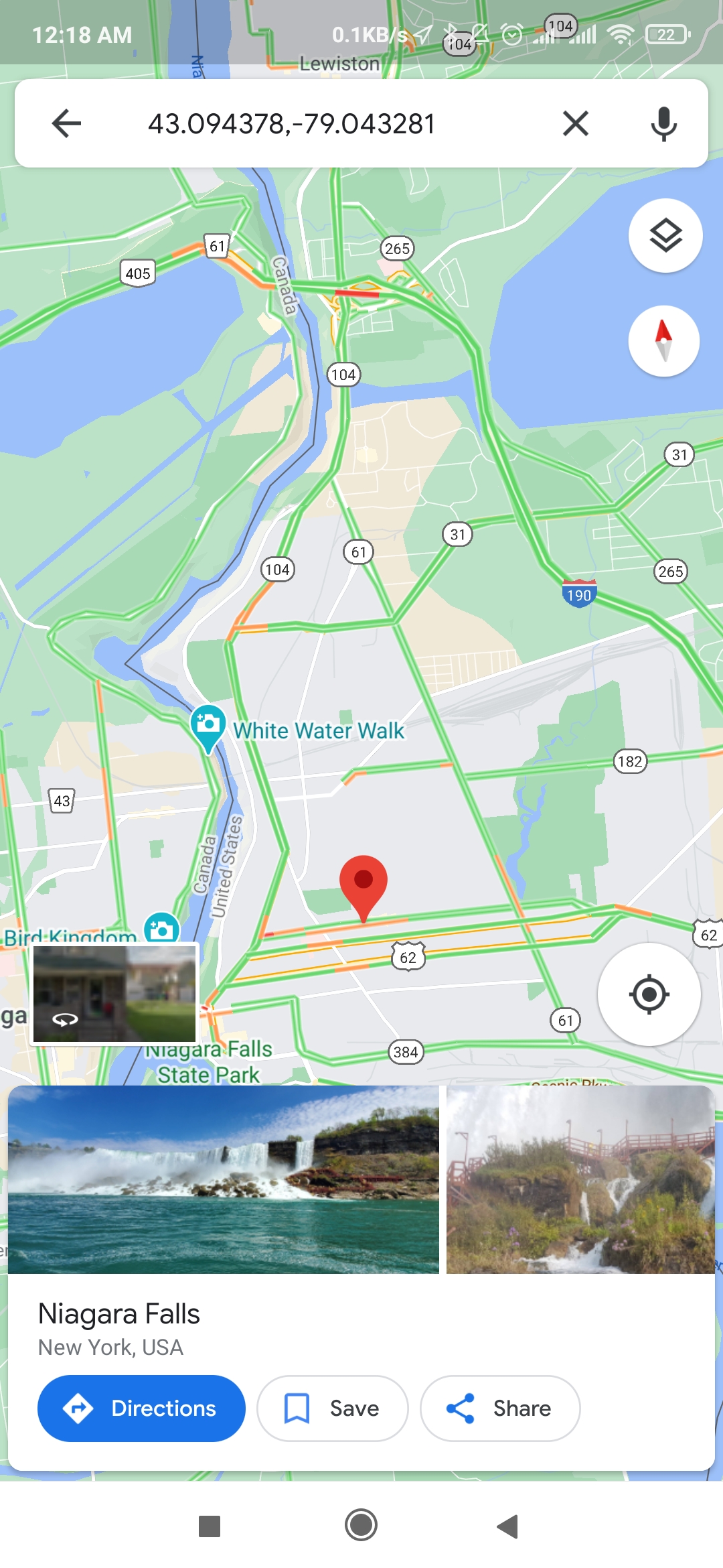
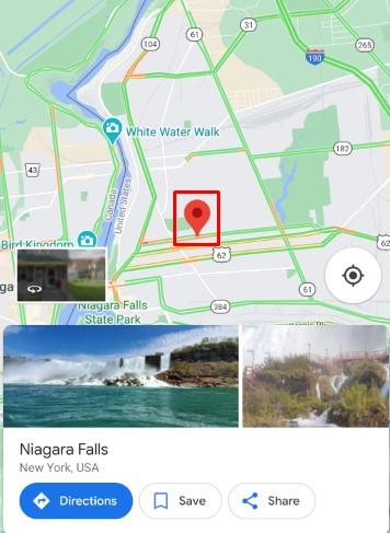
- Open the Google Maps app.
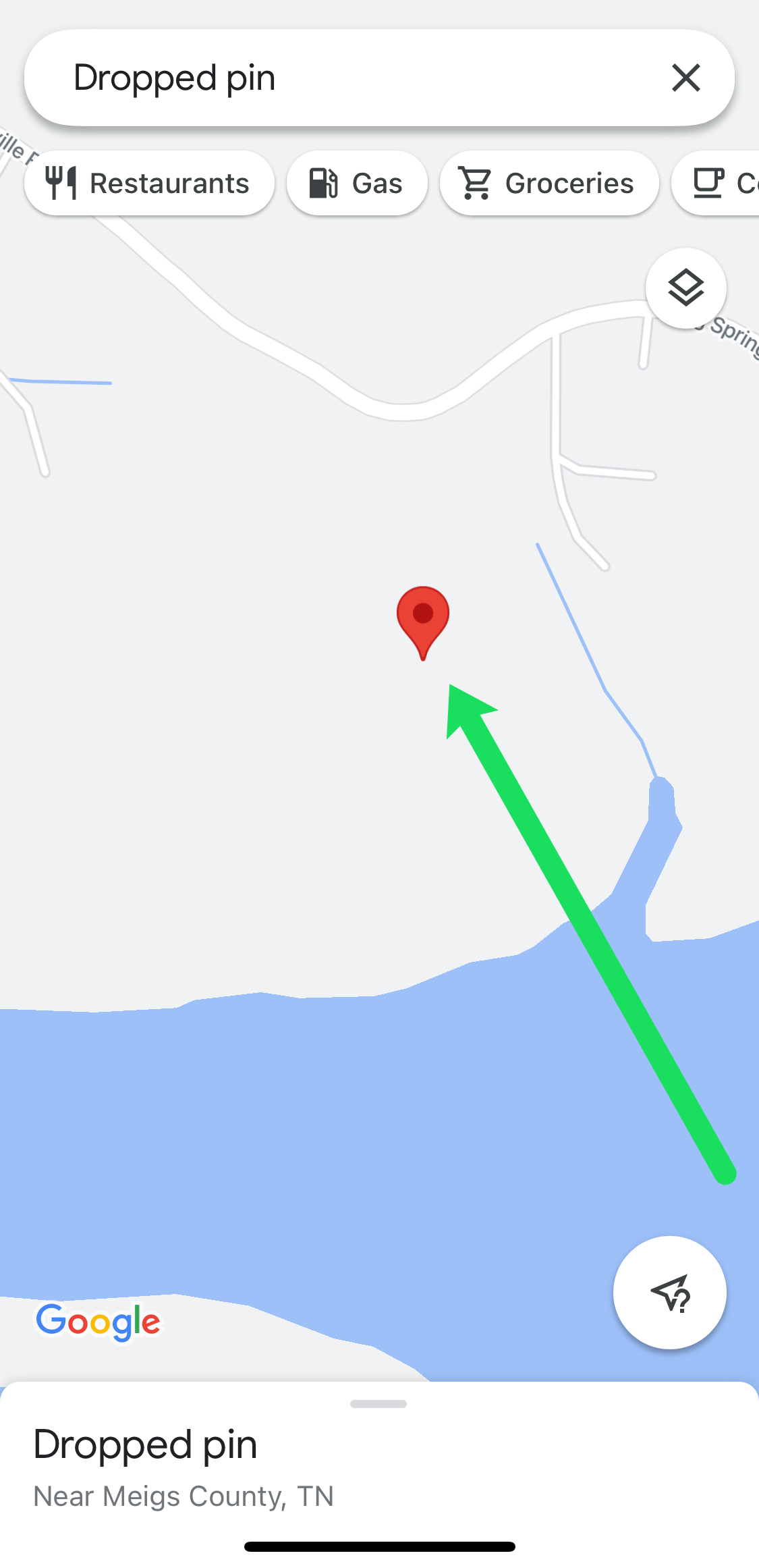
- Tap and hold on an unmarked place on the map. You can use your finger to zoom in on the map and avoid other pins.

- A red pin will appear on the tapped spot tap on the red pin.
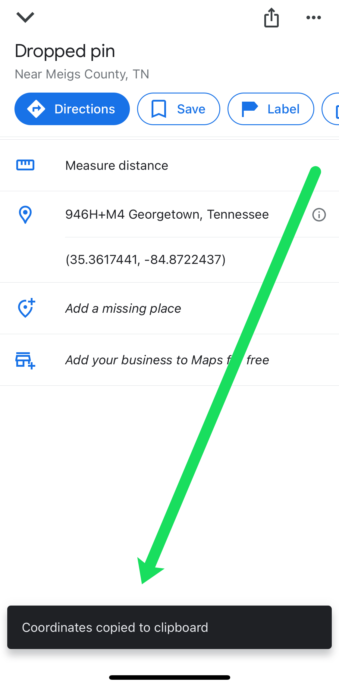
- Swipe up from the bottom of Google Maps to reveal the Longitude and Latitude of the location you’ve selected.
- You can save these coordinates to your clipboard by tapping on them. Then, you can send them to anyone you’d like by pasting them into a messaging app.
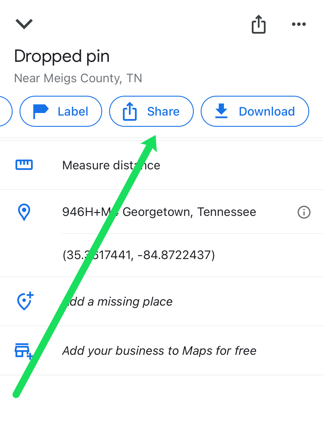
- You can also quickly share the location by swiping to the right in the menu at the top. Tap on Share.

As you can see, it’s really easy to get the GPS coordinates from a random location in Google Maps.
How to Get GPS Coordinates in Google Maps on an Android Device
Android devices are renowned for their ease of use, and Google Maps is no different. If you’re using an Android, follow these steps instead:
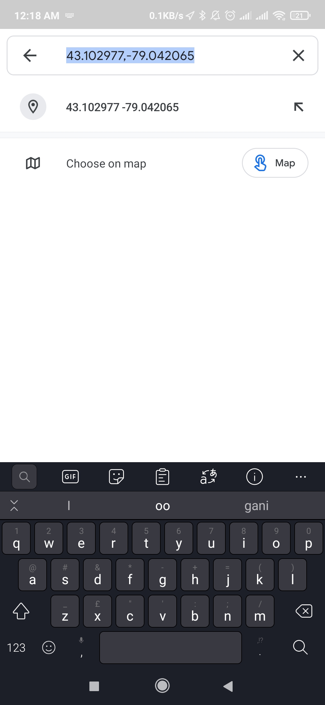
- Open Google Maps.
- Navigate to the place you want to find the coordinates for. You can scroll and zoom with your fingers.
- Tap and hold on an unpinned place on the map.
- A red pin will appear on the spot.
- You will see the decimal coordinates in the search bar.
- You can press the search bar to copy these coordinates to your clipboard.


How to Get GPS Coordinates in Google Maps on a PC
If you’re using a PC, there’s no dedicated desktop app for Google Maps. However, you can easily access it through any browser:
- Open your browser, any browser will do the trick.
- Type in “maps.google.com” in the URL bar.
- Navigate to the place you want the coordinates for by using your mouse. Use the mouse wheel to zoom in or out.
- Right-click on the spot you need. In the menu, select What’s here?
- A small card will show at the bottom with details about the location. The GPS coordinates will be listed as part of the information.


Google Maps makes it really easy to get the GPS coordinates anywhere in the world.
Additional FAQ
Device Links
ragraph">Here are some more answers to your most frequently asked questions.
Can I also get Latitude and Longitude from Google Maps?
Pins represent all locations on Google Maps. These pins can be the ones you made by pressing on the map or searching for a place. There are also pre-existing pins such as landmarks, recommended restaurants, or nearby hotels. When you select a pin on the map, the latitude and longitude information is listed on the menu.
The data is shown in the full degree, minute, second (DMS) form, with the shortened decimal degree form below it. You can then send this information to someone else to provide them with the correct directions.
How accurate are the GPS coordinates received from Google Maps?
Google receives images from several sources and puts them together to form Google Maps. According to Google itself, they claim to have an accuracy of at least 15 meters. Considering 15 meters can be a lot, some scientific research has been done to verify and adjust those claims. They concluded that the offset could range between 1.5 meters and nine meters, depending on the area surveyed.
Generally speaking, you can count that any given point might be several meters off. Cities will have more images available, and Google will more frequently update their maps of urban centers than in the countryside. However, high buildings and signal interference can cause GPS locations to sway more in denser areas. Google Maps will be accurate enough to allow people to meet up or provide directions for everyday use. If you need a precise location of your house, for example, to settle a border dispute with your neighbor, you’ll need to contact your local surveyor instead.
What is a Plus Code in Google Maps?
A plus code serves the same purpose as Latitude and Longitude. It can help others pinpoint an exact location (like the entrance to a building). You may notice that some locations in Google Maps only show the plus code and not the GPS coordinates.
This code can be shared with another person to help them find an exact location.
Location, Location, Location
You can use Google Maps in so many situations, like getting to your dinner date on time. The GPS coordinates will make sure that you don’t get lost. However, Google doesn’t offer 100% accuracy, as that’s impossible to do. But for daily use, Google Maps is an incredibly useful tool.
What do you use Google Maps for? Do you have a set of favorite GPS coordinates? Let us know in the comments section below.
Disclaimer: Some pages on this site may include an affiliate link. This does not effect our editorial in any way.