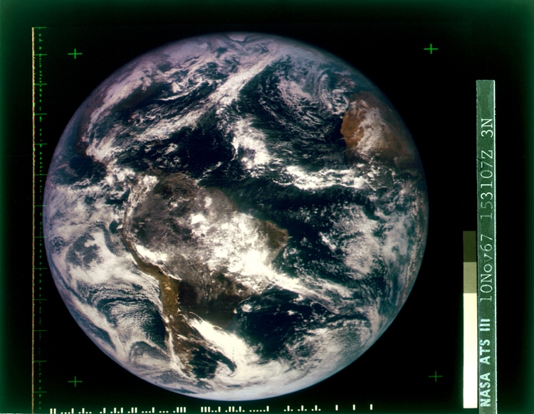
Ever since the Soviets kicked off the space race proper in 1957, humanity has been flinging satellites in the orbit of our home planet in ever increasing numbers.
Of the over 8,000 satellites launched since Sputnik, nearly 2,000 are currently still working. There are a huge range of uses for the images of the Earth taken by those satellites. The uses run from the mundane, like using data for traffic management, to the personal, such as seeing exactly when they knocked down your old house, to the more esoteric, like so-called space archaeology.
Until recently, it was very tricky to find an organized library of past satellite images, but over the last few years, the number of options available has started to grow. We’ve listed a few of the easier-to-use options here so you can get started on your journey into the past.
Google Earth Pro
First, you need to make sure you’ve downloaded the latest version of Google Earth Pro. This version of Google Earth is only available on desktop computers and can run on PC, Mac, or Linux.
Alternatively, you can download Google Earth onto a phone running iOS or Android. The browser version doesn’t currently supply anything but the latest available image.
Once you follow that link, click on ‘Google Earth Pro on desktop’, and the page will scroll down automatically. Click on ‘Download Earth Pro on desktop’, then run the installer once it has finished downloading.
Open up Google Earth Pro, and find the location that you are interested in on the map. You can either type it into the search bar at the top-left or spin the globe about yourself until you find what you’re looking for.
Now that you have the location, click on ‘View’ in the top menu bar, and then click on ‘Historical Imagery’. Alternatively, you can click on the button with a clock and a green arrow going in a counter-clockwise direction.
You should now see a bar on the top-left of the map image, which is a timeline of all the available satellite imagery for your selected location. The vertical lines on the timeline are the different dates that they have photos for. By default, the slider will be all the way to the right, which is the most recent one they have.

You can click on the zoom buttons on the timeline to reduce the timeframe covered by the bar, which can be helpful if there are many images available for the period you are looking at. Also, changing the zoom level on the map itself will provide you with a different range of options to choose from.
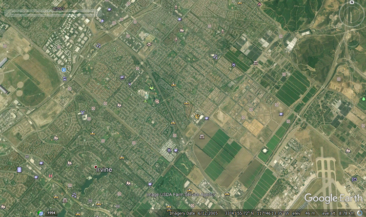
Here we can see three images from three different dates, taken above the city of Irvine, California. The first picture is from 1994.

The next is from 2005
And finally, the most recent, from 2018.
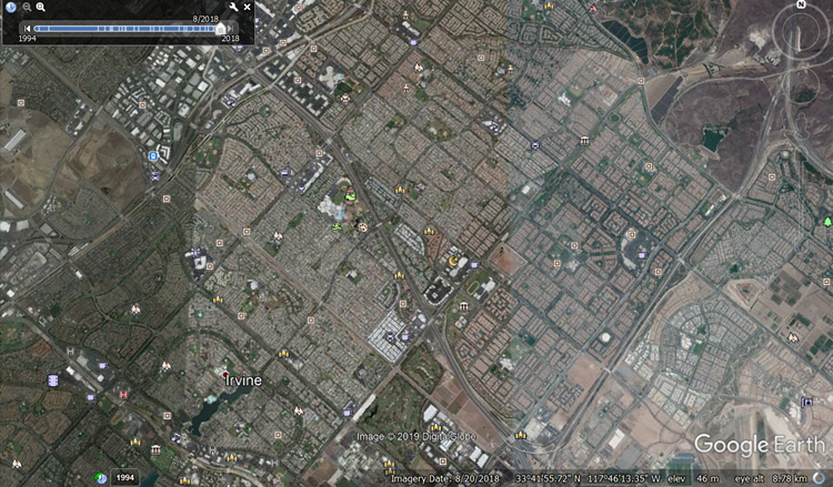
As you can see from the timeline bar, there are usually more photos available the closer you get to present day, as there are many more satellites taking much higher resolution images of the Earth nowadays than there were 20 or 30 years ago. The further back you go, the harder it will be to find decent images.
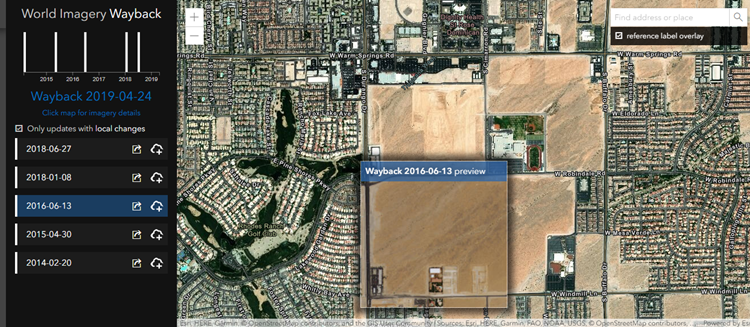
Esri’s Wayback Living Atlas
Although it only goes back to 2014, this is a digital archive of all the world imagery that the mapping software company Esri has compiled so far. It has a good number of images covering the last five years, so if what you are looking for is relatively recent, there’s a good chance of them having a photo for you. It also provides available information on things like demographics, traffic, and weather, and it is constantly being added to as new images become available.
Once you’ve navigated to the location that you’re interested in, you can use the list on the left of the screen to select the image updates that include the area you are looking at. It also shows you a preview of the changes between the image you are looking at and any of the others on the list.
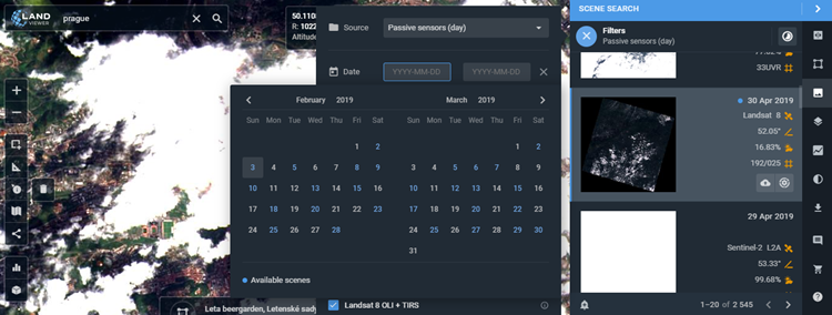
Landviewer
This cloud-based satellite imagery viewer has a large range of sources available, from free satellites like Landsat to commercial ones like SpaceView. It provides you with a number of filters and options, such as only showing images with no cloud cover or using an infrared filter to highlight vegetation. The filters are found to the right of the screen and give you a calendar to go through which tells you which days they have images for.
Landviewer only allows 10 scenes to be viewed before you have to start paying for the service, and the highest-resolution images are also locked behind a paywall, but the range of options still makes it a solid choice.
On Top of the World
These are some easy-to-use options that we’ve found. If you’ve found a service that you prefer, let us know in the comments below. Also, be sure to tell us what you will be using your historical satellite images for now that you know how to find them.
Disclaimer: Some pages on this site may include an affiliate link. This does not effect our editorial in any way.