Britain has joined the world of Minecraft, after an intern at Ordnance Survey translated detailed maps into the game.
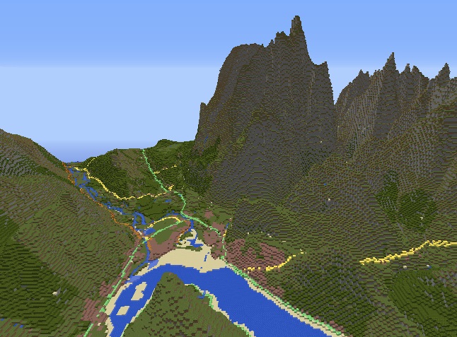
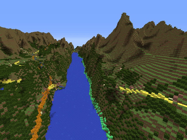
Minecraft is a game where players build their environment out of 3D blocks. Players can develop their own worlds, and one university student has recreated a (largely) accurate version of Britain using detailed Ordnance Survey maps and 22 million Minecraft blocks.
The Minecraft model can be downloaded for free, with the game starting at Ordnance Survey’s Southampton office – from there, you can go anywhere in the blocky version of Britain, from Stonehenge to Snowdonia.
We spoke to Graham Dunlop, manager of Ordnance Survey’s Innovation Lab, to find out how the project came to be.
Q. How did the Minecraft map of Britain come about?
A. At the start of this year, we decided that we’d run a summer internship, to recruit undergraduates to come get some work experience… I interviewed quite a few undergraduates and recruited Joseph Braybrook. He’s a physics undergraduate at Bristol who has done a little bit of programming.
During the interview, he mentioned he was a big Minecraft player and he’d always thought of trying to create a real-world terrain. And I said, well, you’ve come to the right place. That was the beginning of the idea, and when he joined us in August he spent his first two weeks doing that.
Q. What did he have to do to translate your data into blocks?
A. He had to understand Minecraft structure – what’s called a world file, basically a big file that describes how you build the bricks. That file format is quite well documented… and once he understood how to create that file format he then looked at how he could build the model using our digital mapping data.
Q. How detailed is this version of Britain?
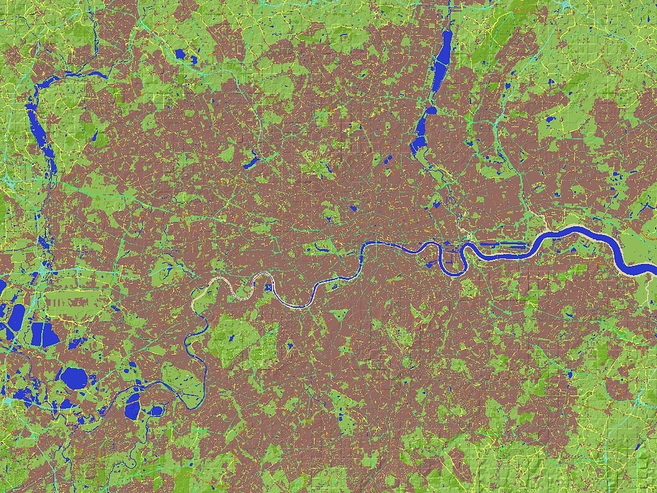
A. The thing that drives the resolution is our height data. We have a product – imagine a grid put over Great Britain with every point on the grid 50m apart. At every one of those points on the grid, it gives you the height of the landscape, that’s called a digital terrain model, and from that you can build a very blocky model of a landscape.
It doesn’t give you very fine resolution because every point is 50m apart, but you can imagine that’s enough to approximate the landscape. That fitted quite well with Minecraft, as it’s quite blocky.
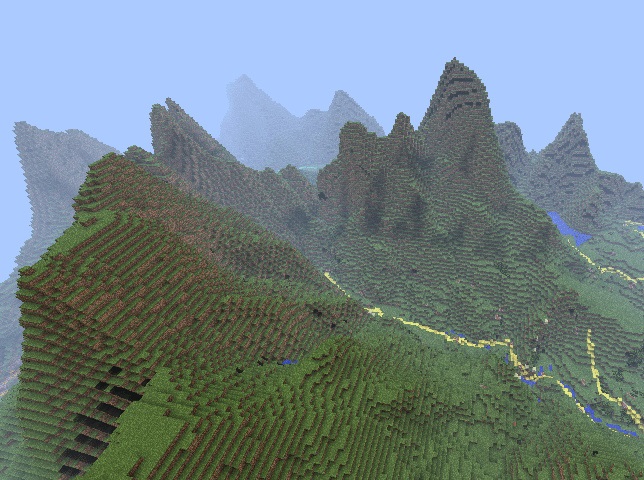
In terms of height, it [the Minecraft file] doesn’t represent the real world. We found that putting the raw data in Minecraft looked pretty flat, because the highest mountain in Great Britain isn’t actually very high.
So we exaggerated the heights, so coastal features like the cliffs of Dover or other lower lying features, you could actually see them. We exaggerated the height by about ten times. If you’re in a hilly region like Snowdonia or Ben Nevis that looks really hilly, but it makes it look a bit more interesting.
It’s not geographically accurate from that perspective, but in terms of where hills are and features like main roads and rivers, it’s reasonably accurate.
Q. What challenges did you face?
A. Most of it was to do with the Minecraft file format. There aren’t many toolkits out there that help you deal with it, so Joe had to learn the nuts and bolts of that.
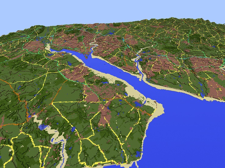
And, we found that after we generated the terrain, it wasn’t actually very nice to look at, because it was all made of rock – that was the initial material. Then we looked at how can we make the landscape a bit more interesting.
So we used another one of Ordnance Survey’s free products, which is more a conventional map… and that’s what we used to extract motorways and A-roads and forests and urban areas. We used that to extract materials for the blocks, which makes it look a bit more lifelike.
Q. The maps used for this were both open source. Why was that?
A. We’ve got a set of a dozen mapping products that are free to access, a part of something called OS Open Data…
Joe initially wanted to do something a bit higher quality, and we have some commercial data that’s a higher resolution, but if you wanted to do the whole of great Britain that would use a lot more blocks and already the file we’ve created is pretty big.
And also it seems too good an opportunity to miss in terms of publicising open data and what you can do with it. It’s proved a great showcase.
Q. What else are you working on in the Labs?
A. Joe’s left Ordnance Survey now, but he did one other project that was a similar theme, taking another open data set, which represents all of the postcodes in Great Britain. He built an interactive presentation of 1.7 million postcodes.
We’re doing some work on augmented reality, digital mapping with some of the latest augmented reality toolkits. We’re looking at indoor positioning… we do buildings and roads, but we don’t map the inside of buildings. So we’re trying to work out what that market means to us and what opportunities there are.
And we prototype a lot of online services, ways of delivering web mapping. We have a service that delivers our digital mapping to web and mobile apps, so we do a lot of work improving those products.
Q. Have you started playing Minecraft?
A. I’m dipping my toe in the water. I’d heard of Minecraft and seen some of the crazy things people had built with it, but I didn’t really appreciate the size of the audience and the fact it was being picked up by so many kids and used so much in education.
It’s something I’m going to track a lot more – I’m not sure I’ve got time to play the game, but it’s a great thing to understand. It seems to encourage a lot of creativity and wild and wacky ideas.
Disclaimer: Some pages on this site may include an affiliate link. This does not effect our editorial in any way.