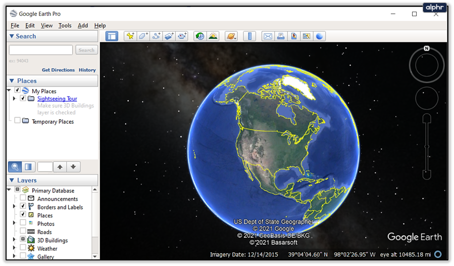
Google has drastically changed the way we use maps. With its detailed street view with businesses, schools, and restaurants entangled with metro and bus lines, it created a way for everyone to get to point A to point B quickly. Also, it’s now available to every person with a smartphone, who has access to the internet.
In this article, we’ll tell you all you need to know about how to change the year on Google Earth, how to use its new features, and how it compares to Google Maps.
Changing the Year
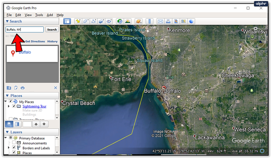
Every map you open with Google Earth Pro has a date, and now there are past versions of some of the maps available, which you can access by following these steps:
- Open Google Earth.
- Type an address or choose a location.

- Find a “View” option and click “Historical Imagery.”
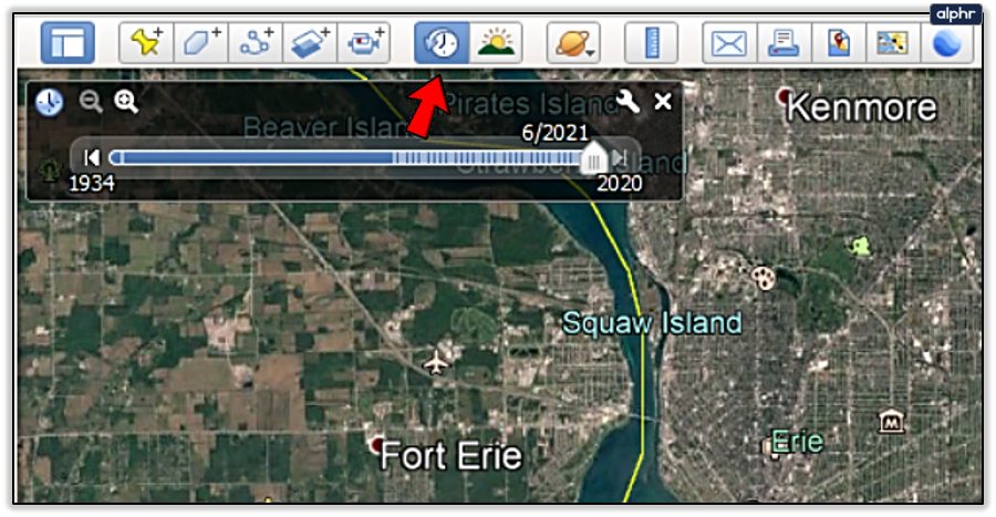
- Above the 3D viewer, there’s a small clock icon, and when you click on it, you will automatically access the time viewer.

Changing the Time of Day
Google also enables its Google Earth Pro users to change the time of day on maps to see how a specific street or park looks when there’s more or less daylight. By clicking the sun icon, you can hide it or unhide it. Moreover, there’s a way to display animated sunshine across a landscape or cityscape, depending on the selected preference.

Google Earth’s New Features
Quite recently, Google Earth became available for everyone through all web browsers. It now offers new features that show locations around the globe with staggering precision. With its complex 3D satellite data, it’s possible to access any point globally and locate cities, mountains, islands, etc. These are some of its useful features:
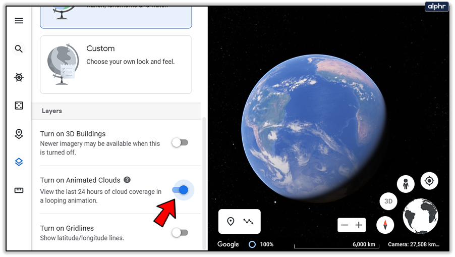
Animated Clouds
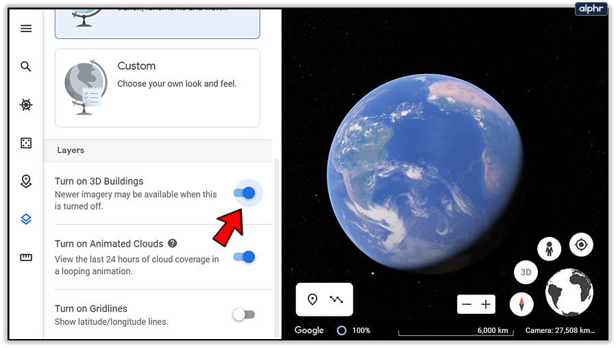
You can now watch cloud coverage in the last 24 hours with a looped animation on Google Earth. Every hour, the system gets an update, and it can create beautiful images and videos. You can access this option by opening Google Earth, clicking on the “Map Style” from the left menu, and clicking on “Turn on Animated Clouds.”
2D and 3D Images
Google Earth can show all its data in 2D and 3D format, and you can choose which you want through “Map Style” options. To get the newest images, in most parts of the world, you should use 2D, and it also improves your app performance as it doesn’t require a lot of memory as the 3D model.
Dark Mode
Should you want to use Google Earth in dark mode, you can change it in the “Display Settings” menu. You can turn both Light and Dark mode on or off.

Google Earth Voyager
Voyager showcases 3D images from all around the world and creates collections of places connected with a story. Its approach is educational as it portrays the world’s nature, cities, and history with help from Google’s massive data-collection and platforms.

Projects and Stories on Google Earth
Google Earth enables students to collaborate on a project or create and share their voyages through digital stories and animations.
Google Maps
Google Maps is a well-known mapping app, developed to offer precise directions and navigate people through any part of the planet and help them arrive at their destination. If you need to find where something is and how to get there, you’ll have to use Google Maps.

Google Earth
Google Earth has been around longer than Google Maps, and it uses 3D satellite images to portray the whole planet. You can explore the landscape and urban areas and see how they look at different times of the day, with or without sunlight, and discover something new every time. By typing precise coordinates, you’ll be able to see every place on Earth with all its details.
Similarities and Differences
The Google Maps app is something everyone needs daily, whereas Google Earth is used in specific situations for science projects or by travelers who’re exploring new paths. You can use it to virtually visit places in 3D and see how they look, as well as check out some of the wonders of the world or famous monuments. When you combine these two apps, you can learn so much about every place in the world, regardless of its distance from you.

Nowadays, Google Maps is packed with data about traffic, restaurants, and pretty much anything you’ll need to use it on-the-go. On the other hand, Google Earth works better on your computer, as it requires a lot of processing power that surpasses any phone’s abilities.
Times Are Changing
While Google Maps contains all the navigational data and points of interest, Google Earth has 3D data involving the whole planet but not a lot of navigational info. The two platforms combined are a powerful tool for anyone interested in traveling and exploring.
Now that you know how to change the year on Google Earth Pro and use some of its features, what’s the first place you would like to see? Would you use the Voyager feature?
Let us know in the comments section below.
Disclaimer: Some pages on this site may include an affiliate link. This does not effect our editorial in any way.