You have most likely heard about Google Earth. But have you ever heard about its younger brother, Google Earth Pro?
This article will take an in-depth look at both versions of this popular software and explain everything you need to know as a potential user. It will also help you decide which version is best suited to your needs. Let’s start with the regular version of Google Earth.
What Is Google Earth?
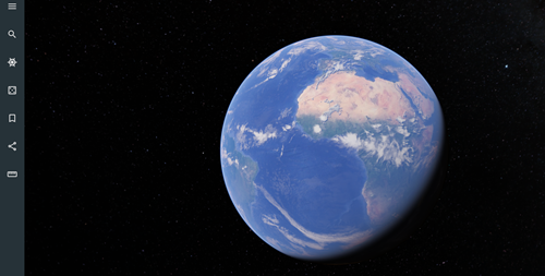
Google Earth has been around for 18 years now, and from the looks of it, this software is here to stay. In essence, Google Earth is a computer program that has the ability to render a 3D model of Earth.
This model is primarily based on satellite imagery. The program works by superimposing GIS data, aerial photography, and satellite images onto the previously mentioned 3D globe.
In other words, Google Earth does mapping so that users can inspect Earth as if it was in front of them.
You can use Google Earth to move all around the globe, but you can also zoom in and inspect whatever street you want using Street View. Of course, those aren’t the only features found in Google Earth.
Let’s see what other options you can expect from this program.
Imagery
This program’s imagery is shown on the digital 3D representation of Earth. It displays the Earth’s entire surface by using one single composited image which was taken from a far distance.
If you zoom in enough, the images will change, showing you the closer version of the area that you have zoomed in on. Of course, this imagery will now have more details. The accuracy of these details can vary from place to place as the images weren’t taken on the same date and at the same time.
Google’s servers are used to host the imagery. Thus, every time you open Google Earth, the software will connect to the servers and exchange data. As such, you need to have an internet connection to run the software.
3D Objects and Imagery
Google Earth can show lifelike 3D building, street, and vegetation models in some locations, and even display their photorealistic 3D imagery.
In this software’s initial versions, the buildings were primarily made using programs for 3D modeling, such as SketchUp. They were then uploaded to Google Earth using 3D Warehouse.
Many updates later, Google announced that they will be replacing their previous 3D models with auto-generated 3D meshes. The change started with larger cities and gradually spread to other places around the globe.
Street View
Since April 2018, people can use Google Earth to inspect whatever streets they like as Google Street View is fully integrated into Google Earth. This feature displays a 360-degree street-level, panoramic photos.
Water and Ocean
Since 2009, Google Earth users can “dive” into the ocean by zooming in below the surface. This feature supports more than 20 content layers.
The information for this feature has been gathered from oceanographers and leading scientists.
Other Interesting Features
- Google Moon
- Google Mars
- Google Sky
- Flight simulators
- Liquid Galaxy
Google Earth is available on most popular operating systems, including Windows, Android, Linux, iOS, and macOS.
Previously, users needed to download Google Earth on their computers to enjoy all of its features. Nowadays, you can use the browser version of this program that contains all the features mentioned above. That way, you can save a lot of space on your device.

As a cherry on top, all of this is completely free. You can test it out here.
What Is Google Earth Pro?
Google Earth Pro is a geospatial program that also displays a 3D model of Earth. This software allows its users to both analyze and capture Earth’s geographical data.
Simply put, Google Earth Pro is a level up from Google Earth as it is packed with more features that can be used for professional purposes.
This is exactly the reason why Google Earth Pro used to cost $399 annually. Luckily, since 2015, Google Earth has become free to use for anyone.
The Pro version of the software has all the same basic features as Google Earth. With that in mind, you can use Google Earth Pro for almost everything that you would use Google Earth for. However, there are important differences.
First, let’s start with Google Earth Pro’s additional features.
Advanced Measurements
Google Earth Pro allows its users to use advanced measurement tools to measure land developments, parking lots, etc.
High-Resolution Printing
Users can print high-resolution images that they’ve taken in Google Earth Pro with a resolution of up to 4800×3200 pixels.
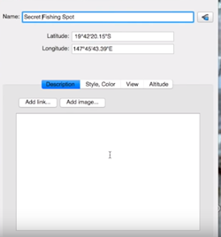
GIS Import
Users can visualize MapInfo (.tab) and ESRI shape (.shp) files.
Movie-Maker
This software allows its users to export Windows Media and Quicktime HD movies.
Exclusive Pro Data Layers
The exclusive data layers include parcels, traffic count, and demographics.
You can download Google Earth Pro from the official website.
Which Version Should You Choose?
As you can see, Google Earth is the beginner software that everyone can use to inspect Earth, learn more about our planet, or navigate toward a certain destination.
On the other hand, Google Earth Pro is meant for more serious, professional use. Of course, the decision is entirely up to you. It depends on what you want to do and what you need this software for.
Some of the essential differences that you should be aware of include the following:
- You can print screen resolution images in Google Earth, while you can print premium high-resolution photos in Google Earth Pro.
- Google Earth requires its users to manually locate the areas that they want to view. Google Earth Pro helps users automatically find those locations.

- You can import image files in Google Earth. As for the Pro version, you can use Google Earth’s Super Image Overlays feature.
Generally speaking, if you need Google Earth’s features for business purposes, your obvious choice should be the Pro version. If you just want to have fun and learn something new, then the basic Google Earth version is for you.
Have Fun Exploring Earth
There are so many things you can do with this software, whether it’s learning about new cities and countries, finding specific locations and landmarks, or planning the routes to use and places to visit on your upcoming vacation. Remember to have fun in the process and enjoy exploring Earth.
Which of these two versions is more appealing to you? Are there any similar programs that you would want to recommend? Let us know in the comments below.
Disclaimer: Some pages on this site may include an affiliate link. This does not effect our editorial in any way.